Feeds:
Posts
Comments

From a bushwalker’s point of view, Mt Warning volcano did a marvellous job 22 million years ago when it created the heights that now form Springbrook National Park.

Five walking trails are available through the forests of this 900-metre tall plateau, the longest at 17km and the shortest at just 300 metres. They are spectacular in the variety of vegetation and wildlife they offer.

Warrie Circuit, the longest of Springbrook’s trails at 17km, incorporates a 4-kilometre loop called the Twin Falls Circuit. Together they form one of the most spectacular walks in south-east Queensland.

The Blackfellow Falls can be seen towards the end of the Twin Falls circuit, just before the short sharp climb back to the top of the plateau. After the spectacular views of Twin Falls and a short walk through dense rainforest we reached the Blackfellow Falls. This is another waterfall that you have to walk under to be on your way and does not have a big overhang for you to walk under so getting wet is expected. Luckily my camera bag has an inbuilt raincoat.

 pics

The scenery once you are back on top of the plateau in the final stage of the circuit walk (which includes both walks) is stunning.

 pics

The vegetation change in descending from the clifftops to the forest floor is remarkable, from montane heath to blue mountains ash to warm temperate rainforest to sub-tropical rainforest, all in a drop of a few hundred metres. This stand of blue mountains ash is rather special, forming the northern-most fringe of a species that stretches south for 600km. Scientists have found this elegant eucalyptus needs the regenerative effects of a fire every 50 years to reproduce.

Closer to the ground, the Warrie Circuit and Twin Falls Circuit are teeming with life. Walkers may be lucky enough to see a blue Lamington spiny cray, or hear lyrebirds in the cooler months, or be startled by jet-black land mullets (the largest skink in the world) sunning themselves beside the track.

The track at the base of the escarpment winds through virgin forest left unlogged by the pioneers of the 19th Century. Walkers may notice a horseshoe-shaped cliff just south of Blackfellow Falls arcing around a stand of brushbox trees, all about the same age. These germinated in the 1890s after several hundred metres of the cliff face collapsed, leaving a scar that could be seen in the early days from Main Beach.

Entries to these walking circuits are at Tallanbana picnic area, about 6km beyond Springbrook village on Springbrook Road. Allow at least six hours for Warrie and two-and-a-half hours for Twin Falls.

Springbrook Maps of Warrie Circuit and Twin Falls Circuit

Directions
For the Springbrook Plateau:
From Surfers Paradise take the Pacific Motorway and take the Mudgeeraba exit (exit 79 from the north, exit 80 from the south) and follow the Gold Coast-Springbrook Road. Or from Nerang follow the Nerang-Murwillumbah Road for 42km then take the Springbrook turn-off at Pine Creek Road. Both bitumen roads are steep and narrow.

More Gold Coast scenic walks

(click on images to enlarge)

Has a nice ring, don’t you think Martie. A book in the making!

 This is Martie’s dream to spend a year in the Kruger National Park (KNP) travelling north and south and stay at the various camp sites; and bring her sightings and photos to everyone by blogging on SANParks website. At present Martie is on day 72 of her stay in the park and her 9th day at the Punda Maria site.

 I met Martie on Facebook when I became a fan of the Kruger National Park and learned of her plan to spend a year in the KNP, South Africa.  Martie is South African and now lives in Doha, Qatar. Being South African myself (now living in Australia) I enjoyed many family holidays in KNP and have a keen interest in living Martie’s dream through her eyes (and ears!).

 Click on this link to read Martie’s post/letter before her arrival at KNP wherein her excitement is evident.

 Martie is a courageous lady to be doing this on her own and I admire her. When you read the blog you will realise the trials and tribulations she has to go through. For those of you who are not familiar with the KNP click on this link – KNP details with a map and aerial view of the park to learn more about this park. 

 Martie on Shingwedzi Bridge 

Not only does Martie bring you the ‘bush’ but also sets the scenes at the camp sites and introduces you to the people she befriends. Best of all are Martie’s dinners which she explains in detail each day and emphasises that she only cooks on the fire. Another book in the making!! ‘Fire cooking in the KNP’ – it would be a best seller with the amount of people that visit the KNP each year!

These are just a few of Martie’s photos that she has captured on her daily outings into the bush and has kindly allowed me to display them here. Martie was concerned that they might not be good enough for my website but as you can see they are outstanding and a pleasure to exhibit.

 (click on images to enlarge)
You can follow Martie’s ‘Living My Dream’ too by bookmarking this site and enjoy each days reading.

 To really get the feel and experience the bush there are three webcams that are updated every 30 seconds on the SANParks website. Click on this link to view the waterholes and experience the bush in real time.

 Good luck Martie for the rest of your dream!

A crisp clear day dawned and it was time to revisit the Springbrook National Park.  It had rained for nearly a week on the Gold Coast and the creeks were flowing strongly which meant for magnificent waterfalls.


The Twin Falls circuit walk is accessed at the Canyon Lookout and although everything was sodden and muddy we ventured into the dense vegetation wearing good walking shoes. It did not take long before our shoes were filthy dirty!


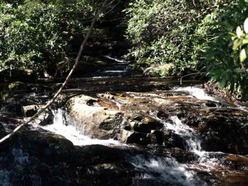
We started to descend into the valley and our first stop was at the top of the Twin Falls. It was breathtakingly beautiful as four creeks merged as little waterfalls out of the vegetation to become one at the top of the falls.


Top of Twin Falls, where the 4 creeks meet


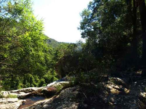
At this point we cross over the top of the falls on a walkway and to our left was the magnificent Twin Falls with the water cascading down and a view over the valley.


Top of Twin Falls where the water cascades down into the valley


We descended further in to the valley walking next to sheer cliff edges and passing through some small caves formed by rock clefts and huge boulders. We wound our way still further down passing numerous smaller waterfalls along the way until we reached the bottom of the Twin Falls.


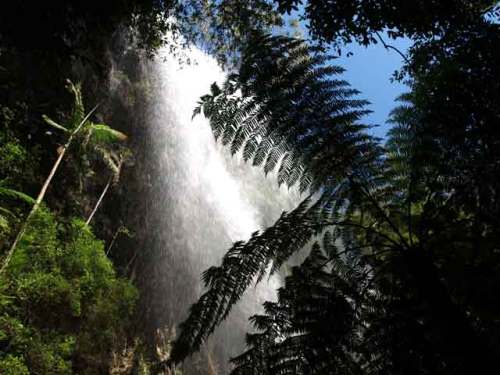
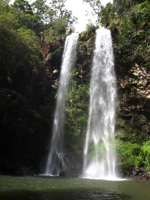
This was awesome – standing in the spray and looking up at the water cascading down which was deafening. We were able to walk under the falls, behind the water plummeting 60m down into the rock pool.


Bottom of the Twin Falls


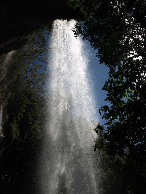
I was able to capture some good shots while walking through the spray although I, my camera and glasses were slowly getting drenched. The sheer thrill of being behind all that water is something to cherish.


Under the Twin Falls, behind the water plummeting down


Coming out the other side of the falls.


The Twin Falls


We still had a way to go now that we were at the bottom of the valley; and an encounter with another stunning waterfall before the 200 stair climb to the top.


All this in the next post…


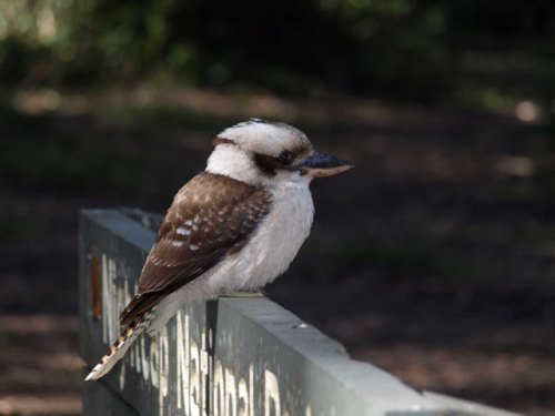
A Kookaburra welcomes you to Nightcap National Park. In fact, he was quite tame, no doubt from receiving a morsel or two to eat!


A Kookaburra welcome


There are two walks through the Minyon Valley with its ancient rainforest vegetation.


Minyon Falls Walk

This is a 6km (approx. 2 hour) moderate walk which includes some hills to experience the amazing Minyon Falls in the spectacular Nightcap National Park. Walk through the beautiful brush box rainforest valley to the plunge pool of the 100m Minyon Falls and see magnificent Strangler Figs, Bangalow Palms and Helmholtzia Lily along the way.


Minyon and Condong Falls Walk

This is a 9km (approx. 4 hour) walk through beautiful brush box rainforest to experience two awesome waterfalls Condong Falls and Minyon Falls. On your way see magnificent Strangler Figs, Bangalow Palms and Helmholtzia Lily and stop at the Minyon Falls plunge pool before walking on to the Condong Falls.


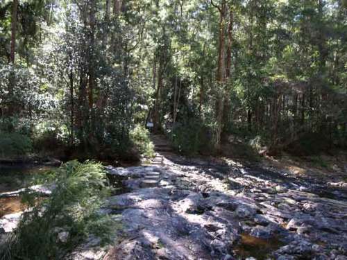
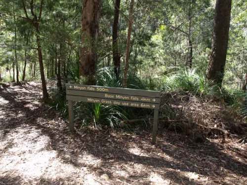
Start of the Minyon Falls walk and onto the Condong Falls.


Minyon Falls walk and onto the Condong Falls


Directions to the Minyon Falls.


Directions to Minyon Falls


What to bring

·         Wear a pair of sturdy covered shoes.

·         Bring a raincoat as the weather is changeable in the ranges.

·         Bring sunscreen and a hat.

·         Bring at least 750ml of water.


Where is

The Nightcap National Park is easily located from Byron Bay, Lismore and Ballina. For directions go to this link – Nightcap National Park


The Weather

You might want to check out the weather at Bureau of Meteorology before planning your trip.

The Minyon Falls can be found in the Nightcap National Park whose ranges form the southern rim of the massive Tweed volcano caldera, one of the largest and best preserves of its type in the world. Mt Warning is the plug from this extinct shield volcano which once had a diameter of over 100km.


Two thirds of Nightcap National Park is a World Heritage area after logging of the Daintree was stopped in this significant ecosystem. Whian Whian State Conservation Area which is adjacent to Nightcap NP plays an important role in protecting the catchment area of Rock Creek Dam, and provides an extended protection zone for Nightcap and protects threatened species.


Standing on the viewing deck, which extends out over the valley is breathtaking in itself, as there is nothing but the platform under you. The untouched Minyon valley with its ancient rainforest vegetation and the Minyon Falls that rise over 100m out of the rainforest, is an awesome view.


This pic was taken from the top of the falls as the water cascades down; and shows just how high the falls actually are by the view through the trees.


Top of Minyon Falls


Minyon Falls – taken from the viewing deck.


Minyon Falls


Further upstream and deeper into the rainforest.


Minyon Falls Rainfores


More to come … some easy bushwalking …