Feeds:
Posts
Comments

Archive for the ‘Scenic Photography’ Category

A crisp clear day dawned and it was time to revisit the Springbrook National Park.  It had rained for nearly a week on the Gold Coast and the creeks were flowing strongly which meant for magnificent waterfalls.


The Twin Falls circuit walk is accessed at the Canyon Lookout and although everything was sodden and muddy we ventured into the dense vegetation wearing good walking shoes. It did not take long before our shoes were filthy dirty!


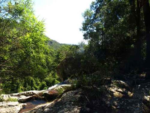
We started to descend into the valley and our first stop was at the top of the Twin Falls. It was breathtakingly beautiful as four creeks merged as little waterfalls out of the vegetation to become one at the top of the falls.


Top of Twin Falls, where the 4 creeks meet


At this point we cross over the top of the falls on a walkway and to our left was the magnificent Twin Falls with the water cascading down and a view over the valley.


Top of Twin Falls where the water cascades down into the valley


We descended further in to the valley walking next to sheer cliff edges and passing through some small caves formed by rock clefts and huge boulders. We wound our way still further down passing numerous smaller waterfalls along the way until we reached the bottom of the Twin Falls.


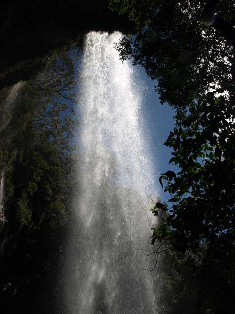
This was awesome – standing in the spray and looking up at the water cascading down which was deafening. We were able to walk under the falls, behind the water plummeting 60m down into the rock pool.


Bottom of the Twin Falls


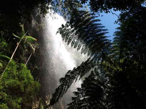
I was able to capture some good shots while walking through the spray although I, my camera and glasses were slowly getting drenched. The sheer thrill of being behind all that water is something to cherish.


Under the Twin Falls, behind the water plummeting down


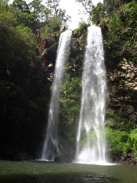
Coming out the other side of the falls.


The Twin Falls


We still had a way to go now that we were at the bottom of the valley; and an encounter with another stunning waterfall before the 200 stair climb to the top.


All this in the next post…


Read Full Post »

The Minyon Falls can be found in the Nightcap National Park whose ranges form the southern rim of the massive Tweed volcano caldera, one of the largest and best preserves of its type in the world. Mt Warning is the plug from this extinct shield volcano which once had a diameter of over 100km.


Two thirds of Nightcap National Park is a World Heritage area after logging of the Daintree was stopped in this significant ecosystem. Whian Whian State Conservation Area which is adjacent to Nightcap NP plays an important role in protecting the catchment area of Rock Creek Dam, and provides an extended protection zone for Nightcap and protects threatened species.


Standing on the viewing deck, which extends out over the valley is breathtaking in itself, as there is nothing but the platform under you. The untouched Minyon valley with its ancient rainforest vegetation and the Minyon Falls that rise over 100m out of the rainforest, is an awesome view.


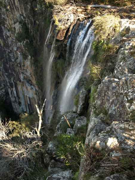
This pic was taken from the top of the falls as the water cascades down; and shows just how high the falls actually are by the view through the trees.


Top of Minyon Falls


Minyon Falls – taken from the viewing deck.


Minyon Falls


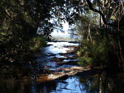
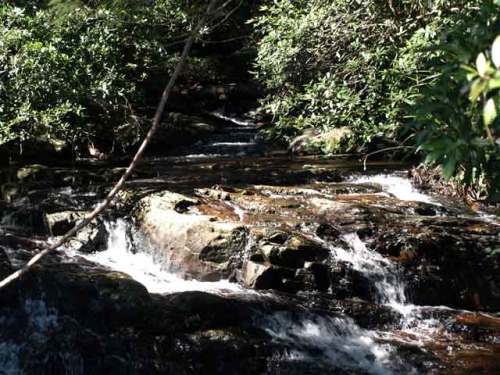
Further upstream and deeper into the rainforest.


Minyon Falls Rainfores


More to come … some easy bushwalking …


Read Full Post »

 Natural Bridge, Springbrook National Park is a most unusual geological feature created over millions of years by water tumbling through the roof of a basalt cave. Natural Bridge is home to an amazing colony of glow-worms, whose lights can be seen only after sunset. Lookouts and lush rainforest also grace this World Heritage-listed haven, making it one of the most popular parks in Australia.

Natural Arch

As we entered the park we were greeted with huge tree. Looking up the trunk made for a spectacular photo as it seemed to keep going forever.

Natural Bridge Park

We took the short circuit walk through the lush rainforest to the natural arch over Cave Creek.

Natural Bridge Circuit

The view of the unique waterfall cascading down into the cave through its roof is amazing.

Natural Arch

We ventured into the dark cave and got closer to the waterfall which was almost deafening as it tumbles into the cave with the sun shining through.

Natural Cave

We left the cave and did the easy climb to the top of the Waterfall where we dipped our hands into the pools of very cold water.

Natural Arch Waterfall

As we walked through the park we could hear the calls of paradise riflebirds, green catbirds and wompoo fruit-doves.

There is also an area where you can enjoy a picnic and relax in the cool rainforest.

Nocturnal tours are also available to see delicate glow-worms and on summer nights you can see luminous fungi and fireflies.

Mini-bus tours also run to the park from the Gold Coast and Murwillumbah.

How to get there …

Please note that the scenic access roads are winding and should be travelled with care.

Natural Bridge is located on the Nerang-Murwillumbah Road, about four kilometres north of the border gate. From the Pacific Highway, you can turn off at Nerang (30 kilometres to the park) or at Mudgeeraba (42 kilometres to the park via Springbrook plateau).

Read Full Post »

Teviot Falls are found on the McPherson Range near Wilson’s Peak in Queensland, Australia, close to the border with New South Wales.


 Teviot Falls


We travelled along the Main Range Drive and as we entered the Teviot Forest Reserve the trees enclosed the road. On the partially unsealed road up the range is the Teviot Gap, also known as The Head, and this is the best place to view the falls.


Teviot Falls Reserve


We stopped and took lots of pics of the breathtaking views.


View from Teviot Falls Reserve


We were amazed at the way the landscape changes along this route.


On the way to Carrs Lookout


We stopped at the Carrs Lookout at the top of the winding mountain climb to view the vast patchwork of the valley floor below, reaching up the edges of the surrounding peaks. The Great Condamine River begins in this Darling Downs Valley and flows west to become part of the Murray Darling River System in the south of NSW.


Carrs Lookout


We continued along this route to the Queen Mary Falls…  (Described in the previous post)


Read Full Post »

Bush walking is one of the many pleasurable experiences around the beautiful Queen Mary Falls.


On the Western slopes of the Great Dividing Range, Spring Creek winds its way through the park, plunging 40m over the sheer rock face of Queen Mary Falls.


Queen Mary Falls are located in Main Range National Park. In the Condamine River headwaters where the Spring Creek cascades over a waterfall into a rain forested gorge.


Within the park you can enjoy picnicking, bushwalking, studying nature and admiring the views from the lookout. To make the park more enjoyable it features picnic tables, shelter sheds, public toilets and drinking water.


This area is known as the Central Eastern Rainforest Reserves World Heritage Area.


The circuit walk is an easy short walk, approximately 2 kilometres which will take you about an hour, longer if you take binoculars to do some bird watching of the rare species seen within the park; and your camera to capture some magnificent shots of the spectacular waterfalls and towering open forest.


The area is a photographer’s paradise.


Queen Mary Falls 


The walk takes you down to the foot of the falls where you find absolute peace and tranquillity.


We walked down through the tall open forest dominated by towering forest red gums and brush box to subtropical rainforest in the gorge. Our first view of the spectacular Queen Mary Falls was a delightful surprise to see the waterfall drops 40m over the glistening basalt rock to the gorge below.


As we crossed Spring Creek, we walked through a fine mist spray from the waterfall. The amazing thing is that you can actually get up close to the cascading water by walking over rocks to almost stand under it. Standing in the cool mist spray was also a relief from the heat that can be felt in the park. We also saw small eastern water dragons’ sunbaking on the rocks and spiny cray scurrying around the rock pools.


Photo of the bottom of the waterfall, in the spray.


The bottom of the falls, in the spray.


We climbed steadily back up to the picnic area which completed the circuit walk, passing through open forest with flowering Banksia shrubs and wattles, casuarinas, bush orchids and native ferns. There are also beautiful rock pools at the top where a pleasant swim and paddle can be had.


Photo taken on top of the waterfall.


On top of Queen Mary Falls


Two things I need to do – get binoculars to enjoy the bird species on the next visit and to make sure the visit is in the springtime to experience the beauty of the wild flowers.


Queen Mary Falls are actually the top tier of three waterfalls situated in the mountains behind the small town of Killarney. A little further on are Daggs Falls and Browns Falls that are not quite as high, but I have been told are equally as beautiful.


Browns Falls and Daggs Falls are at the bottom of the range leading up to Queen Mary Falls. Browns Falls are also very beautiful. There is a 20 minute walk in from the road near Browns Falls picnic area which is well worth the walk. A short adventure along the creek, a little rock hopping, and you feel as if you are in an unknown wilderness.


Daggs Falls can be seen from a platform lookout about 3km below Queen Mary Falls, and are just as spectacular as Queen Mary Falls.

This is something to experience on my next visit…


How to get there … because I know you will want to visit this park. (This is for you … Yanina Yoga)

Queen Mary Falls is about 42km east of Warwick and 11km east of Killarney on the Killarney-Boonah Road near the New South Wales border. This section is about 2.5 hours south-west of Brisbane via Boonah or Beaudesert and the Teviot Gap Road or via Cunningham’s Gap and Freestone or via Warwick.


Read Full Post »
Older Posts »